Interactive campus map adds priority snow routes as winter approaches
Did you know that the Western interactive campus map, accessible through the WWU home page’s Map menu or by visiting www.wwu.edu/map, now has a snow route layer?
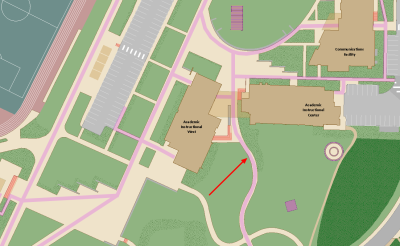
The new layer shows the areas on campus that are cleared first and have highest priority in the event of snow and ice; sticking to these routes during inclement weather will insure you are getting to class or work using the safest route available. By default, the priority snow removal route layer is enabled on the campus map this time of year; to turn it on or off, simply check or uncheck its layer in the map’s “Features” pull-down menu.
You can also click on any portion of the snow route to see if it is ADA accessible; alternatively, you could also enable the “accessibility” layer as well as the snow routes layer, as users can activate as many layers as they would like to the map simultaneously. Other helpful layers include the locations of bus stops and bike racks; parking lots; emergency phones; food services, and more.
The snow route later and interactive campus map was designed by Stefan Freelan of the Spatial Institute in Western’s Huxley College of the Environment.
To navigate to the map, either use the URL above or go to the WWU home page and click “Map” in the upper right corner, then click “campus map” from the maps page (see screenshots at right). The interactive map will then load.
For any questions about the map or to suggest new content, contact Stefan Freelan at Stefan.freelan@wwu.edu.
